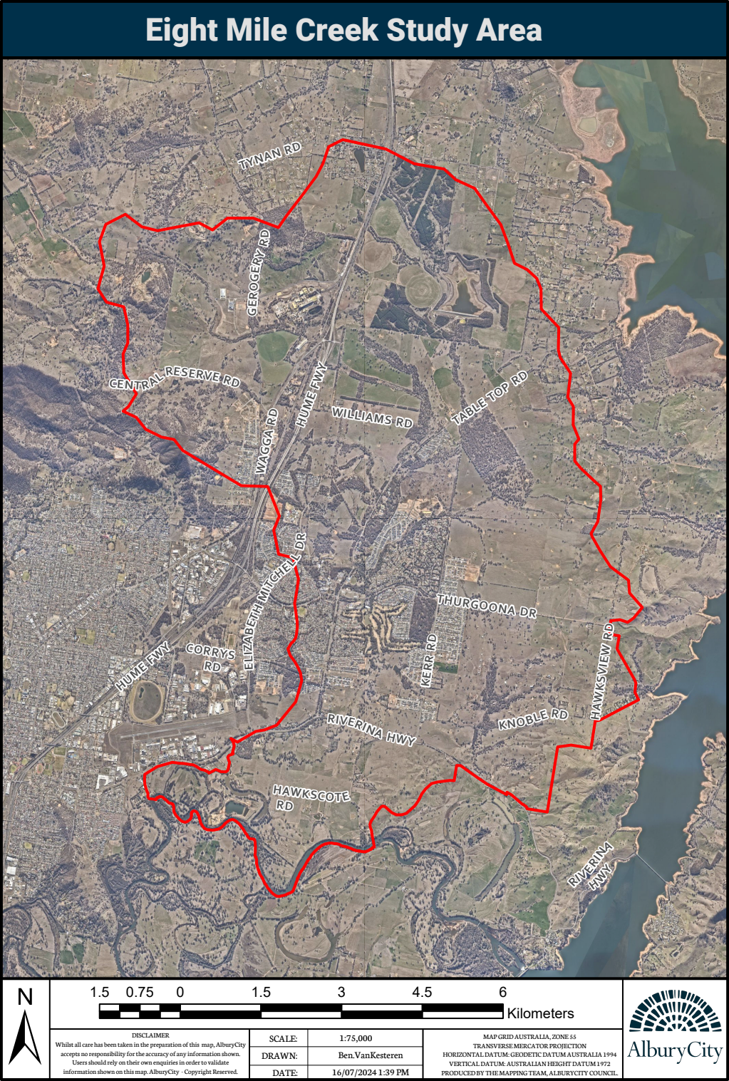
The Eight Mile Creek Flood Study Review catchment area includes suburbs, Thurgoona-Wirlinga, Table Top, Ettamogah and Springdale Heights.

We’re seeking input from landowners, residents, and businesses on historic flooding within the Eight Mile Creek catchment Area (Refer to the red outlined area in the map below). To provide your input, visit our Have Your Say page.
We’re working with consultants, Lyall & Associates Consulting Water Engineers, to conduct a comprehensive review of previous flood studies for the Eight Mile Creek Catchment Area. This review will make any necessary updates to flood information based on current catchment conditions.
We’re seeking input from landowners, residents, and businesses on historic flooding within the Eight Mile Creek catchment Area (Refer Figure 1, within the red outline). Please submit your responses to the survey below by Monday, 7 October 2024. Your responses will assist us in identifying the key flood issues within the Eight Mile Creek Catchment Area.
The Eight Mile Creek Flood Study Review will develop an updated set of flood models which will be used to more accurately define the nature of both Main Stream Flooding and Major Overland Flow under current catchment conditions.
The Eight Mile Creek Flood Study Review aims to enhance community resilience to flooding by improving development planning, emergency management and community awareness. The findings of the Eight Mile Creek Flood Study Review will also help inform the Thurgoona Wirlinga Precinct Structure Plan Review.
This review will be undertaken in accordance with legislative requirements of the NSW Floodplain Risk Management Manual, in summary include:
